Gone With The Wind St. Barbe, NL to St. Anthony, NL
This morning I woke up for the first time in Newfoundland. The strong winds that I mentioned yesterday persisted throughout the night and while it kept me awake for a while I eventually drifted off and even slept through the night which I think was a first for this trip. As is turns out, it would not be my only “first” of the day.
I had pretty much decided last night that today I would start the trek southwest towards Gros Morne National Park. After a couple of conversations with people on the boat I was less inclined to make the detour trek to St. Anthony – as Brad mentioned in the Guestbook, it would be a heck of a detour.
So, I packed up my gear hoping to be on the road by 9:00; however, I wasn’t as organized as I should’ve been (especially considering I’ve been doing this for a month now). By 9:20 though I was riding away from the campground. And as feared, the winds were strong – actually that would be a bit of an understatement. It turns out the winds were in the 35-40 km/h range.
The Highway 430 junction (ie. The Viking Trail) was only about a ten minute ride from the campground. Last chance. Turn right for Gros Morne. Turn left for a heck of a detour. I looked right. I looked left. I looked right again and that’s when it hit me (no, still not a truck). Every time I looked to my right the wind hit me right in the face. Did I mention it was a 35-40 km/h wind? Then I gave it some more thought and concluded there was no real reason to NOT go to St. Anthony. Sure, it’ll likely end up adding about 350km to the trip but isn’t that what I’m here for (well, at least one of the reasons). So, I decided I would go where the wind was pushing me. And with that I turned left and headed for St. Anthony.By the time I reached Anchor Point (ie. about 20 minutes) I was confident I had made the right decision. The scenery of all the coves along the coast was fantastic. The roads were flat and in good shape – minimal shoulder but equally minimal traffic. And that wind. That oh so glorious 35-40 km/h wind pushing at my back the entire time. I didn’t worry about the nasty headwind that would likely be awaiting me on the way back, I just enjoyed the ride.
The ride continued like that for about 45km at which point I reached Eddie’s Cove and the turn Google wanted me to make. Well, this one was a no brainer. As much as I wanted to continue following the coast (ie. Google’s route), the route in question was a gravel road. If I’ve learned anything on this trip it’s that my bike and gravel roads aren’t a particularly good combination. So, I left the coast behind and headed inland. And the wind followed.Just to clarify the scope of this detour, the route to St. Anthony is about 125km. Now, I’m not going to say this was the easiest 125km I’ve ever done, but it might be. I remember one day in New Zealand where it was a gentle down hill for nearly 120km. That was a good day too but it was also overcast all day. This one was pretty special. Sunny skies guided my way, and the wind was in my favour about 95% of the time. I reached St. Anthony in just under 5 hours with an average speed of about 27 km/h.
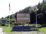
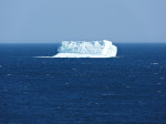
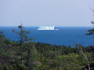 Reaching St. Anthony also brought with it another first. I stopped to take a photo of the “Welcome to St. Anthony” sign and as I was getting ready to leave I glanced across the road towards St. Anthony Bight only to see an iceberg in the distance. I actually didn’t realize what I was looking at initially. I just saw this white thing floating in the water – but it was pretty far away and icebergs weren’t exactly on top of my mind. I’m not sure why, but a couple of locals stopped by at that time and they said that if I go Fishing Point Park that I’d get a better view. Seemed like a good plan to me.
By the time I returned to my bike I have to say I was getting a bit tired. I’d done a pretty good job of eating throughout the day (probably a lesser job of drinking) but I was definitely running on fumes. Oh, and I still hadn’t really figured out where I would be spending the night.
Ok, so I’ll wrap this up with the short version because this is turning into an excessively long update. Stopped at Foodland. Stopped at Subway. Stopped at Tim Hortons. Returned to “Welcome To St. Anthony” sign. Set up tent behind said sign and am hoping no one will notice (bears and moose included).
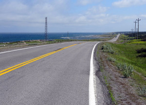
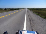
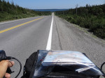
- Riding along Highway 430.
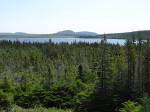
- Another nice view – although, nicer in person.
- No more coast – but still coasting.
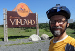
- Welcome to Vinland (although, it’s believed Vinland was much larger than just this area).
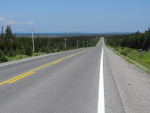
- Another ride along shot on Highway 430 (aka. The Viking Trail).
- Yes, I saw signs for it. No, it’s not in the budget.
- One heck of a detour completed.
- Hey, look! An iceberg!
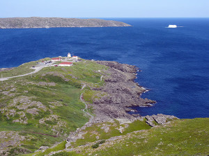
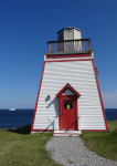
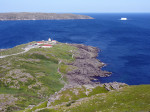
- Lighthouse (and iceberg) at Fishing Point Park.
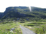
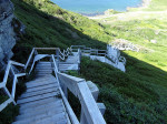
- Are those stairs?
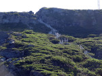
- Yup, definitely stairs.
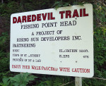
- 476 stairs? Sure. Why not. It’s not like I’ve already done 130km today.
- Yup. Stairs.
- View from the top.
Today’s Totals:
Distance travelled: 137.50km
Time on bike: 5:33:38
Maximum speed: 57.75 km/h
Average speed: 24.70 km/h
Oh, and when I went to Subway I got everything on the sub, as per usual. However, not as per usual, “everything” included pineapple. Pineapple. On a sub. It’s no substitute for poutine but it was pretty great.




Hey Mark – loving your blog. The Grenfell Museum is pretty cool. I don’t think you’ll regret the detour. Hoping to see a pic of you with the polar bear at city hall.