
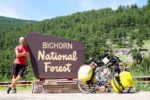
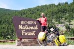
Moving Up In The World Sheridan, WY to Prune Creek, WY
As much as I dislike backtracking, I’m going to do a bit of that to start this update. I didn’t mention this in last night’s post because, well, I didn’t realize it at the time but yesterday’s long ride officially took me past my 2016 European tour and became my third longest ever at just under 3,600 km (2236 miles) … and counting. As a matter of perspective, that’s still about 10,000 km behind my 2015 tour. End of backtracking segment.
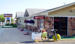
Nice motel. Nice breakfast.
My morning was also everything I needed from the establishment. And maybe more. Yes, it was a small, budget motel and the continental breakfasts at such places can be a bit hit or miss but in this case it was a definite hit. There was a tray of muffins, cereal, a waffle maker, fruit, yogurt, juice, and even hard boiled eggs. The eggs were an extra bonus as I was able to take a few with me for the road. I had a big day of climbing ahead of me so I figured a little extra mobile sustenance couldn’t hurt.
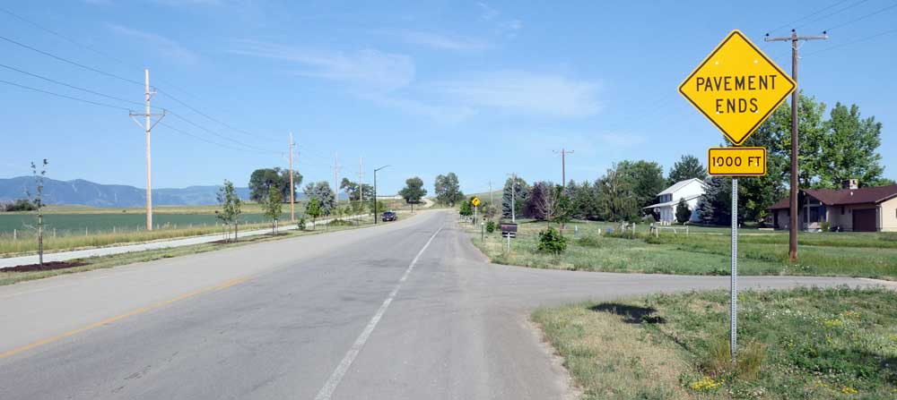
Unfortunately, my day on the road didn’t get off to such a great start. The weather was fine. The bike was fine. But the navigation was sorely lacking. In fact, navigation was a mess to start. My goal for the day was to head towards and then up the Bighorn mountains. Once again, Google and I had drastically different thoughts as to how I should get to said mountains. Sadly, it took about 6 km and one “Pavement Ends” sign to come to that realization. Since I had no idea how long Google’s road would be gravel, I opted to backtrack all the way to the motel at which point I forged my own route. A route which worked out rather well. Yes, I was on the Interstate for a little bit (one exit) but I’m pretty sure that’s legal here. And once I got to that point the routing became much simpler. There was just one road up the mountain.
Sigh
Unlike yesterday’s ride, I had no intention of pedalling any further than my target today. Of course, with my target being a campground there was a chance it would be full in which case moving on would be necessary. But not my idea!
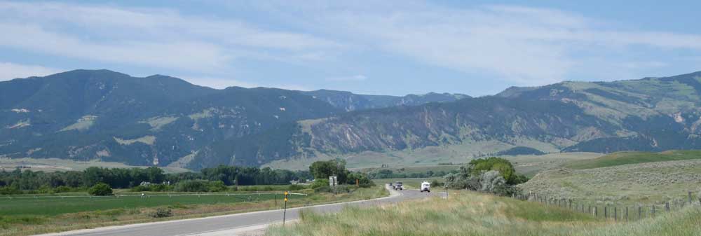
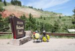
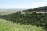
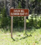
The aforementioned campground was Prune Creek Campground. A mere 63 km away. Why such a short ride? Getting lazy in my old age? Well, the shortness of the ride applied only to distance. The elevation was another story. After all those straight flat roads of Indiana and Illinois … oh, and Iowa … and North Dakota … and South Dakota … and yes, Wyoming too … well, those would all be a distant (or perhaps fond) memory during today’s ride. Today was mostly a climbing day. The first 30 km was flattish to get me warmed up but the subsequent 30 km was a hill. And no, that’s not an exaggeration. It was a 30 km hill with multiple switchbacks. It was a hill that would have me climb about 5,000′ on the day.
There were two small towns between my starting point and the start of my climb. Ranchester and Dayton. I stopped at the former to top up my water and opted to cruise through the latter because stopping would’ve just been procrastination.
Long climb ahead
The next two hours were spent climbing.
I knew that I had about 30 km of such climbing before getting a short 6 km reprieve in the form of a short descent to the campground. I didn’t focus on the distance. Considering my slow rate of travel, that would’ve been mentally draining. Instead I tracked the elevation on my cycling computer. I estimated if I could do 1000′ of elevation per hour I’d be in good shape for a late afternoon arrival. I was perfectly fine with that.
I stopped for lunch around 2:00 PM at a rest area which featured a parking lot and an outhouse. Sadly, there were no picnic tables. Instead, I took refuge from the sun by sitting in the shade of a sign next to the road. Objectively speaking, not particularly ideal but in the moment it was perfect. Or at least perfectly adequate.
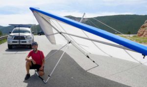
Ready for launch
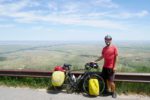
I managed to stay ahead of my 1,000′ per hour goal and reached the summit just before 4:00 PM. Well, actually it was A summit. Not THE summit. It was the highest point before the campground but there would be another two hours of climbing needed tomorrow before I reached the actual summit.
On the upside, it was more than a little nice to have a not-entirely-slight descent from the current summit to the campground. After four hours of pedalling up hill at speeds frequently less than 10 km/h, it was nice to coast for a bit.
As I coasted, there was one less-than-courteous driver that passed me. And, as is often the case, his actions were more than a little puzzling. After spending the better part of four hours on the shoulder while I ascended the mountain, I moved off the shoulder for the 5.9 km of descent that lead to the campground. I did that because, well … gravity and mountain descents tend to have a dramatic effect on my rate of travel. And given the amount of loose stones and other debris on the shoulder, well … I prefer to avoid combining those with high speeds. Bottom line, it’s not like I was in the middle of the road. At all. But as I approached what felt like Mach II, I suddenly heard a horn honking. A quick glance in my mirror revealed a pickup with a trailer barrelling down on me. Rather than slow down (I assumed he had brakes) to let the ONE oncoming car pass he continued to honk his horn as he zoomed by me with a less than ideal amount of space between our respective vehicles. Seriously, there wasn’t a whole lot of room for him to complete this manoeuvre. Fortunately, no harm was done but it does make me wonder how things will go tomorrow. There’s an even bigger descent in my future and I don’t plan on staying on the shoulder for it. Fortunately, all the other drivers have been very generous in giving me space.
I wheeled into the Prune Creek Campground shortly after 4:00 PM. Most of the sites were either taken or reserved but there was a vacancy which I was quick to claim. My 30 km day of climbing was officially over.
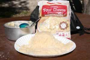
Another bag of potatoes would have helped my sculpture
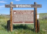
By the way, it would seem I’m in bear country – as per the sign at the entrance to the campground. Fortunately, there’s a (supposedly bear proof) food locker next to my campsite. Of course, if a bear decides to check out said food locker it would put me in VERY close proximity to said bear. Let’s hope that doesn’t happen.
-
- Some very old rocks reside here
-
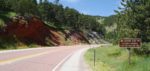
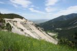
- One of many switchbacks in the background
-
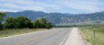
- Another byway travelled on
-
- Looking back
-
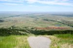
- Nice view
-
- Nice hang gliding launch ramp
-
- Another switchback
-
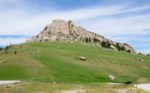
- Steamboat Point
-
- Woohoo!
-
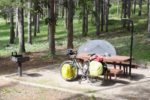
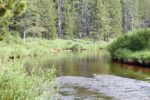
- Prune Creek Campground
Today’s totals:
Distance: 78.81 km
Ride time: 5:13:29
Average speed: 15.08 km/h (by far my slowest day)
Maximum speed: 60.00 km/h (seriously, 60.00 exactly)
I can see you stopped and turned back at W 5th St. to Soldier Creek Rd. It would have been much shorter to get to Dayton.
Well, it would’ve been shorter but with my thin tires I wasn’t about to risk a possible 29 km ride on gravel. In the end, it only delayed my arrival in Dayton by about 30 minutes. And when I was talking to the glider pilot on the mountain, he happened to mention that other route is not pleasant on a bike. At all.