
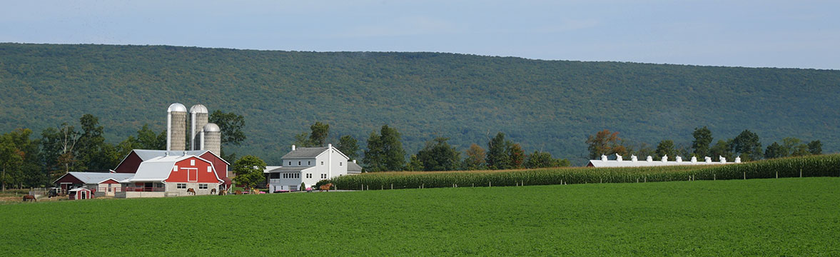
Not How I Planned It Lewisburg, PA to Wellsboro, PA

Wise words.
As you may recall, two days ago I noted there was no need to rush into long travel days. Well, apparently long travel days can begin on Day Four.
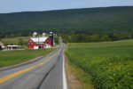
After another great Warm Showers stay, I set course for Cedar Run. There’s not much around Cedar Run but it’s about 110 km from where I was starting my day so it seemed like a reasonable destination.
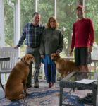
Ben, my host, suggested an alternate route to Google’s route and I was happy for the advice. Sure, I only met Ben yesterday and I’ve known Google for much longer. That said, I had infinitely more confidence in Ben’s directions than Google’s … yes, I’m still a bit angry over the whole logging road fiasco in Scotland. Grrrrr. Anyway, with the course set I was ready to go – after a quick breakfast, of course, and a photo with my hosts.
The first 33 km of the ride could only be described as easy. The same can’t be said for the subsequent 6 km. At all. That’s not to say it wasn’t fun but it certainly wasn’t easy. Ok, maybe “fun” isn’t the right word but I enjoyed it in an excruciatingly exhausting way. Much of the climb in question was about an 8% grade but there was a moment near the top when my cycling computer was indicating a 15% grade – which, after 45 minutes of climbing, is a bit of a harsh finale. Fortunately, there was some pretty instant gratification. As exhausting as going up was, the trip down the other side was more than a little fun. The best way to offset a 45 minute climb is with a 6 minute descent. So fun.
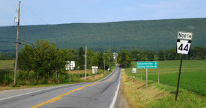
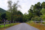
Yup, that road goes up and over that mountain.
And so did I.
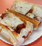
With few stops for provisions along the way, I opted to stop for a sub in Jersey Shore (who knew there was a Jersey Shore in Pennsylvania?). For what it’s worth, I pedalled right past one of those famous chain sub places and went to a local place instead. I had a meatball sub and it was delicious. I kind of wanted two! And by “kind of” I mean “really”.
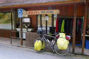
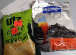
Fast forward a few hours of somewhat effortless riding and I found myself about 10 km from Cedar Run where I stopped at Wolfe’s General Store – the only such store in the area. I figured if was going to stop at Cedar Run for the evening, this would be the place to stock up. By “stock up” I mean I bought two bags of chips and a Creamsicle. One bag of chips and one Creamsicle later, I was back on my bike pedalling my way towards Cedar Run and the end of a nice day of pedalling.
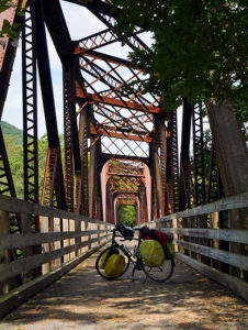
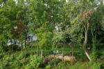
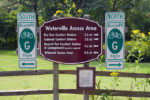
Pine Creek Rail Trail
At this point, I couldn’t hep but think that the recently consumed chips and Creamsicle were an even wiser decision in light of the navigational challenges that were before me. That was the only fuel that was keeping me going at that point.
My backup plan to Cedar Run was Morris. I had no backup plan for that backup plan. So, after consulting the map I decided to continue following the Pine Creek Rail Trail with the hope it would take me somewhere with accommodations. Yes, I realize that’s not the most thought out plan in the world but it was the plan I was going with.
Chips and ice cream for lunch.
Cycling is great.
With the sun slowly setting behind the mountains, I finally escaped the trail and found myself back on a highway. I was still without a cell signal. As a backup, I used my GPS in the hopes it might give me some indication as to what accommodation options were in the vicinity. At this point I was at 148 km for day and really didn’t want to have to resort to searching for a wild camping spot – plus I really needed to get some stuff done on the computer – not the least of which was blog updates before Julie-Ann berates me again (then again, maybe she’s the only one reading … thank you for reading Julie-Ann).
-
- I camped to the left of the chairs last night.
-
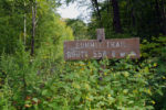
- Summit signs are always so satisfying.
-

- Good place for lunch.
-
- J&M Sub Shop. Not as flashy as those chain sub places but still delicious.
-
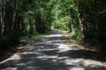
- Pine Creek Rail Trail.
-
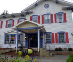
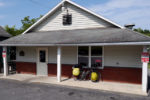
- Coach Stop Inn & Tavern.
-
- Supper. I’ve been carrying around that dehydrated meal for a LONG time.
Today’s totals:
Distance travelled: 150.45 km
Ride time: 7:29:11
Average speed: 20.09 km/h
Maximum speed: 66.60 km/h
I think “berates” may have been a slightly exaggerated term to use,no? ;)
Well, MAYBE slightly … of course, I meant the nice kind of berating. :)
That said, the exclamation marks in your previous two comments COULD be construed as berate-ish (yeah, I know … not a word). ;)
Julie-Ann is not the only one reading! Enjoying the updates and great pictures again.